Survey TEQ logo
عربي
Survey TEQ logo
عربي |
Survey TEQ logo Survey TEQ logo Survey TEQ logo Survey TEQ logo

SurveyTEQ Services

  Who We Are?

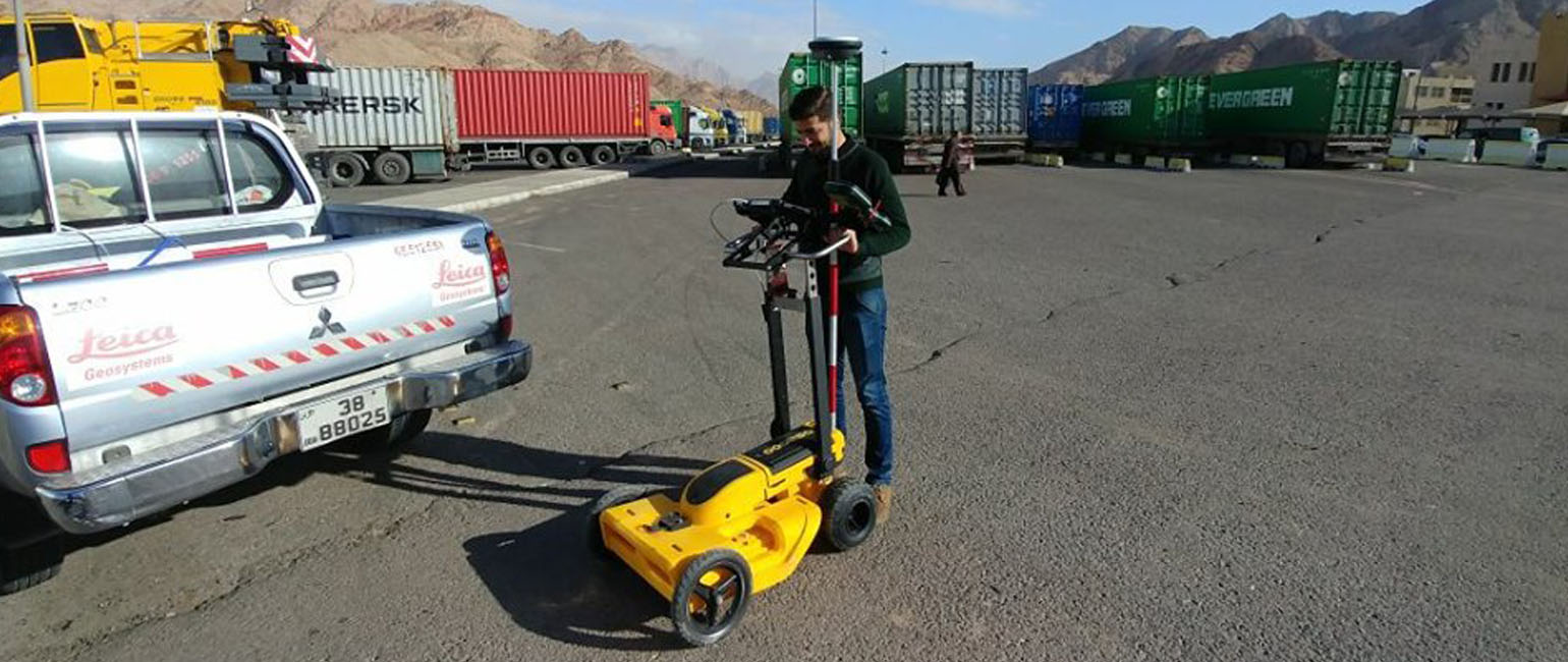
We are specialized in geomatics and surveying engineering fields with modern concept and tools. We carry out all types of data measurements and data collection, managing and performing complex measurement tasks. That includes, GNSS surveying, Asset data collections, GIS mapping, Laser Scanning. In addition to use the Ground penetrating radar (GPR) to investigate utilities underground surface.


 Our Services

SurveyTEQ is established for delivering the best results through a range of different Geospatial techniques. We offer the following Geospatial services:

3D Laser Scanning

3D Virtual Tour & Walkthrough

Volumetric Calculations

Ground Control Points (GCPs) Survey

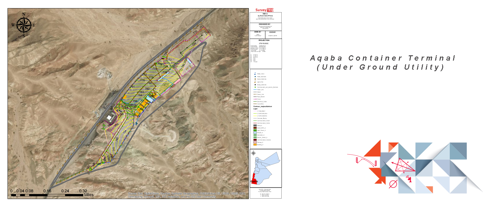
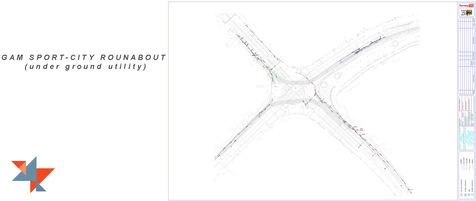
Utilites Mapping by GPR

Asset Data Collections
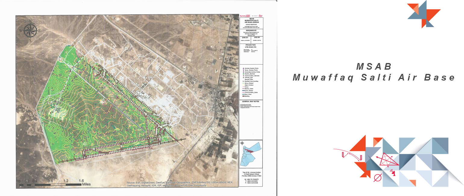
GIS Mapping Survey

As-built Verification by Laser Scanner

Archaeology Survey 


3D Mapping Using Laser Scanner

Laser Scanning, also referred to as Reality Capture or High Definition Surveying is a technology which uses laser beams to measure and capture environments in 3D with speed and accuracy. These services provided to a wide range of clients and project outcomes, and will only continue to grow in popularity with advancements in technology.


Laser Scanning Sample Projects 

As Built BIM Projects (There is attached video)

Tank Calibration (There is attached video)

The Ten Arches Bridge in Amman (There is attached video)

Archaeology Survey Projects (There is attached video)


 Our Service Profile:

https://www.drive.google.com/file/d/1xykJ4XbKjfxwv2JzsT906xTMXwx9RxQM/view?usp=sharing


 Utilities Mapping by GPR

Ground penetrating radar (GPR) is now a well-accepted geophysical technique. It is a high resolution electromagnetic technique that is designed primarily to investigate underground surface utilities like:

    Underground Electrical cables.

Underground pipes (waters, sewer)

Underground Fiber optics.

The GPR is integrated with RTK-GNSS device to get the accurate route of the utilities in addition to the depth.


Volumetric surveys

Volumetric surveys are very useful in a number of quantitative (measurable) ways as well as being a qualitative (visual) representation of a project area of interest (AOI) in three dimensions to compute the cut/fill volume in AOI. We are specializes in volumetric surveys using Laser scanner, GPS and total station devices to output a precise calculations of the volume.


 Assets Data Collections

Assets data collections are very important for supporting decision process and for. Asset Management Systems are dependent on accurate asset data, including the location of the asset, its condition and its attributes. We are using the latest laser scanner & GIS/GPS devices for collecting the assets data. Asset data can be collected at the time an asset is created or at any other time in its life-cycle. We are collecting all type of assets data like electricity, water, sewerage, roads and parks. 


 GIS Mapping

GIS Mapping its techniques of collecting spatial data with attributes information about each feature. Its depends on building a GIS database for your project and transfer this database to your GIS/GPS device and then start collect the position and the attributes for your features in the field.


Surveying Projects

1.      Jordan Industrial Port – 3D Laser scanning and virtual tour-2021

2.      Horse Roundabout Monument in Sahab City – 3D Laser scanning and virtual tour-2021

3.  Madaba Archalogical Buildings Documentation – 3D  virtual tour for all Archalogical Mosaic floors in Madaba-2021

4.   Pauls Church Documentation– 3D  Laser scanning & virtual tour-2021

5.    Qatar Schools – 3D  virtual tour for more than 11 Schools in Qatar--2020

6.     Bank of Jordan- Virtual tour and 2D plans-2020

7.     Jeet Bwatak Resturant Ajloun and Mafraq Branch- Virtual tour-2020

8.     Arab Potash Mine- GCPs Collection for (21) Benchmarks at Dead Sea-2020

9.     Al-Habashneh Surveying-Quantity surveying office - Under Ground Utility Detection by using GPR and Cable Locater at Al-Potash Aqaba-2020

10.   Aqaba Customs Centre - Under Ground Utility Detection by using GPR and Cable Locater; Water Pip, Electrical Lines, Sewer Lines and Fiber Lines , with ADC 2019

11.  Arab Potash New Offices - Under Ground Utility Detection by using GPR and Cable Locater2019

12.  Arab Potash Boundary Wall - Under Ground Utility Detection by using GPR and Cable Locater2019

13. Arab Potash Aqaba - Under Ground Utility Detection by using GPR and Cable Locater2019

14. Aqaba- Jordan Customs Yards Under Ground Utility Mapping by using GPR and Cable Locater; Water Pip, Electrical Lines, Sewer Lines and Fiber Lines  2018

15.  Muwafaq Al Salti Air Base Project (M.S.A.B) As built for Muwafaq Al Salti Air base, with Ch2m  U.S company (Al Azraq-Jordan)2017

16.  Aqaba Ground Control Collection (JREDS) GCPs Collection for Satellite Imagery registration (Aqaba-Jordan)2016


17.  Saudi Ministry of Interior (MOI)2015


18.  Ground Control Points Collection GCPs Collection for Satellite Imagery registration (Amman-Jordan)2013


19.  Kirkuk Ground Control Points Collection  - GCPs Collection with IGS Station coordinates calculation for Digital Mapping (Kirkuk-Iraq)2013


20.  Jordan Chemical Industries Co. (Qatraneh Area) Quantity Surveying (Amman-Jordan) – 2012


21.  Royal Geographic Center Queen Alia Airport As-Built drawing using Laser Scanning with cm accuracy (Amman-Jordan) - 2011


22.  Department of Land and Survey GPS Permanent Station Setup (Amman-Jordan)  - 2006


23.  Sajer Tropographic Mapping Project – Topographic Mapping for 2 sq-km, (Sajer-Saudi Arabia) – 2000

We Use Cookies in Order to Serve You Better